

Poa labillardierei, also known as common tussock-grass,[2] is a species of tussock grass that is endemic to Australia.
Elegant versatile native tussock grass especially useful for erosion control. Happy in any soil, especially wetter areas. Feathery flowerheads in summer add to the appeal. Often recommended in local council planting lists and for bushland gardens.
Click on Map to Enlarge Image
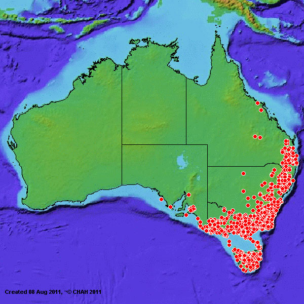
Notes on Maps.
Generally, the concentrated clusters of markers represent the geographical range where this species occurs naturally. Outlying markers and geographically disassociated markers represent observations of the species in cultivation and/or recorded in herbaria etc.
Acknowledgment.
These maps are provided by, and are used with the permission of, Australia’s Virtual Herbarium (AVH)
https://form.jotform.com/221803642855457
